


Island Grove Precinct, Gage County, Nebraska
About
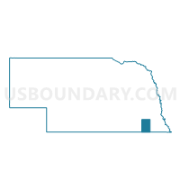
Outline

Summary
| Unique Area Identifier | 613171 |
| Name | Island Grove Precinct |
| County | Gage County |
| State | Nebraska |
| Area (square miles) | 70.00 |
| Land Area (square miles) | 69.23 |
| Water Area (square miles) | 0.78 |
| % of Land Area | 98.89 |
| % of Water Area | 1.11 |
| Latitude of the Internal Point | 40.13551520 |
| Longtitude of the Internal Point | -96.57229340 |
Maps


Graphs
Select a template below for downloading or customizing gragh for Island Grove Precinct, Gage County, Nebraska


Neighbors
Neighoring Voting District (by Name) Neighboring Voting District on the Map
- Barneston/Liberty Precinct, Gage County, NE
- Burchard Precinct, Pawnee County, NE
- Elm/Sicily/Glenwood/Paddock Precinct, Gage County, NE
- Glenwood Paddock Precinct, Gage County, NE
- Lincoln/Riverside Precinct, Gage County, NE
- Rockford/Sherman Precinct, Gage County, NE
- Steinauer Precinct, Pawnee County, NE
- Wymore Ward 1 Precinct, Gage County, NE
- Wymore Ward 2 Precinct, Gage County, NE
Top 10 Neighboring County Subdivision (by Population) Neighboring County Subdivision on the Map
- Blue Springs-Wymore township, Gage County, NE (1,929)
- Riverside township, Gage County, NE (448)
- Precinct 5, Burchard, Pawnee County, NE (394)
- Paddock township, Gage County, NE (385)
- Rockford township, Gage County, NE (290)
- Liberty township, Gage County, NE (283)
- Sicily township, Gage County, NE (193)
- Barneston township, Gage County, NE (182)
- Sherman township, Gage County, NE (181)
- Precinct 7, Turkey Creek, Pawnee County, NE (168)
Top 10 Neighboring Place (by Population) Neighboring Place on the Map
Top 10 Neighboring Unified School District (by Population) Neighboring Unified School District on the Map
Top 10 Neighboring State Legislative District Upper Chamber (by Population) Neighboring State Legislative District Upper Chamber on the Map
Top 10 Neighboring 111th Congressional District (by Population) Neighboring 111th Congressional District on the Map
Top 10 Neighboring Census Tract (by Population) Neighboring Census Tract on the Map
- Census Tract 9647, Gage County, NE (3,521)
- Census Tract 9678, Pawnee County, NE (2,773)
- Census Tract 9652, Gage County, NE (2,771)
- Census Tract 9646, Gage County, NE (2,725)